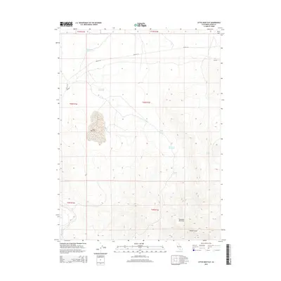
2015 Map of Little Mud Flat
USGS Topo · Published 2015About this map
Skedaddle Mountains dominate the southern portion of this high-desert landscape in Lassen County, where steep-sided volcanic terrain meets the expansive alkali basins characteristic of the region. The central topographic feature, Little Mud Flat, illustrates the seasonal hydrology of the area, supported by a network of water sources including Brubeck Spring and Lava Spring. This 2015 survey reveals a landscape managed for ranching and water retention, evidenced by numerous man-made catchments like Chalk Bluff Reservoir, Lava Rock Reservoir, and Horsecamp Reservoir. Transportation through this isolated corner of California is defined by Gerlach Rd and Idaho Rd, providing access to the rugged Wendel Canyon and the prominent northeast landmark known as Deep Cut.
Find a feature on this map
18 named features on this map. Tap any name to fly to it.
Don’t see what you’re looking for? This feature index may not catch every label — zoom into the map to look around manually.
Map Details
Editions of this 2015 Little Mud Flat Map
This is the sole edition of this map. No revisions or reprints were ever made.
Other maps of this area

1886 · Honey Lake
USGS Topo · 1:250,000

1891 · Honey Lake
USGS Topo · 1:250,000

1893 · Honey Lake
USGS Topo · 1:250,000

1954 · Wendel
USGS Topo · 1:62,500

1954 · Litchfield
USGS Topo · 1:62,500

1954 · Karlo
USGS Topo · 1:62,500

1954 · Shinn Mountain
USGS Topo · 1:62,500

1955 · Westwood
USGS Topo · 1:250,000

1958 · Westwood
USGS Topo · 1:250,000

1959 · Westwood
USGS Topo · 1:250,000