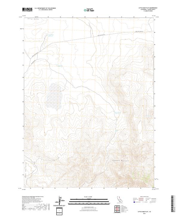
2021 Map of Little Mud Flat
USGS Topo · Published 2021About this map
Secret Valley and the northern slopes of the Skedaddle Mountains define this high-desert region of Lassen County. The landscape is characterized by a network of water management features essential for ranching and survival in the arid Great Basin transition, including Chalk Bluff Reservoir, Lava Rock Reservoir, and Horsecamp Reservoir. To the southwest, the terrain descends toward the Honey Lake Valley, while isolated water sources like Brubeck Spring and Laver Spring dot the more mountainous southern sections. The map traces the routes of Old Humboldt Rd and Smoke Creek Ranch Rd, providing a record of the remote transportation corridors that connect these high valleys and mountain ranges. This survey documents the intersection of natural geological formations and the human-made infrastructure required to sustain the cattle and ranching economy of the early 21st century.
Find a feature on this map
15 named features on this map. Tap any name to fly to it.
Don’t see what you’re looking for? This feature index may not catch every label — zoom into the map to look around manually.
Map Details
Editions of this 2021 Little Mud Flat Map
This is the sole edition of this map. No revisions or reprints were ever made.
Other maps of this area

1886 · Honey Lake
USGS Topo · 1:250,000

1891 · Honey Lake
USGS Topo · 1:250,000

1893 · Honey Lake
USGS Topo · 1:250,000

1954 · Wendel
USGS Topo · 1:62,500

1954 · Litchfield
USGS Topo · 1:62,500

1954 · Karlo
USGS Topo · 1:62,500

1954 · Shinn Mountain
USGS Topo · 1:62,500

1955 · Westwood
USGS Topo · 1:250,000

1958 · Westwood
USGS Topo · 1:250,000

1959 · Westwood
USGS Topo · 1:250,000