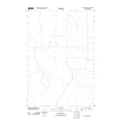
2011 Map of Little Pine Creek
USGS Topo · Published 2011About this map
Little Pine Creek meanders through the heart of this Fallon County landscape, part of a drainage system that includes Hay Creek, Pine Creek, and Brush Creek. The area is characterized by its wide-open topography and a network of rural routes, including the primary north-south artery of Plevna Rd and intersecting gravel ways like Road 318 and Road 302. A notable point of human alteration in this prairie environment is the O'Henry Dam, which manages water flow along one of the local tributaries. This 2011 survey captures the region as a quiet corner of eastern Montana, where the land is defined by long-established section lines and the subtle variations of the plains' watercourses.
Find a feature on this map
8 named features on this map. Tap any name to fly to it.
Don’t see what you’re looking for? This feature index may not catch every label — zoom into the map to look around manually.
Map Details
Editions of this 2011 Little Pine Creek Map
This is the sole edition of this map. No revisions or reprints were ever made.
Other maps of this area

1953 · Miles City
USGS Topo · 1:250,000

1957 · Miles City
USGS Topo · 1:250,000

1958 · Miles City
USGS Topo · 1:250,000

1981 · Baker
USGS Topo · 1:100,000

1981 · Harmon Butte
USGS Topo · 1:24,000

1981 · South Sandstone Reservoir
USGS Topo · 1:24,000

1981 · Little Pine Creek
USGS Topo · 1:24,000

1981 · Baker NW
USGS Topo · 1:24,000

1981 · Seven-Up Butte
USGS Topo · 1:24,000
1981 · Sportsman Pond
USGS Topo · 1:24,000