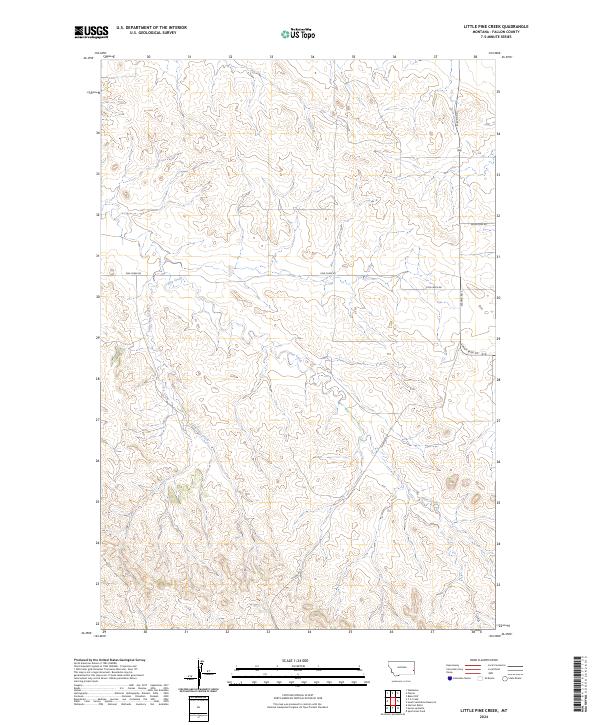
2024 Map of Little Pine Creek
USGS Topo · Published 2024About this map
Little Pine Creek meanders through this portion of Fallon County, Montana, carving a complex network of coulees and drainage basins characteristic of the Great Plains' northern reaches. The landscape is defined by its watercourses, including the central Pine Creek and Hay Creek in the north, which dictate the placement of rural infrastructure. Human activity is marked by a sparse but essential grid of county roads, with Plevna Rd S serving as a primary north-south artery connecting the high plateaus and creek bottoms. This modern topographic study reveals a terrain primarily organized by the Public Land Survey System, as evidenced by the township and range boundaries of t7n r57e and t6n r58e. The placement of Sunny Bank Rd and Pine Creek Rd highlights how local travel remains tethered to the natural contours of the Montana ranchlands.
Find a feature on this map
11 named features on this map. Tap any name to fly to it.
Don’t see what you’re looking for? This feature index may not catch every label — zoom into the map to look around manually.
Map Details
Editions of this 2024 Little Pine Creek Map
This is the sole edition of this map. No revisions or reprints were ever made.
Other maps of this area

1953 · Miles City
USGS Topo · 1:250,000

1957 · Miles City
USGS Topo · 1:250,000

1958 · Miles City
USGS Topo · 1:250,000

1981 · Baker
USGS Topo · 1:100,000

1981 · Harmon Butte
USGS Topo · 1:24,000

1981 · South Sandstone Reservoir
USGS Topo · 1:24,000

1981 · Little Pine Creek
USGS Topo · 1:24,000

1981 · Baker NW
USGS Topo · 1:24,000

1981 · Seven-Up Butte
USGS Topo · 1:24,000
1981 · Sportsman Pond
USGS Topo · 1:24,000