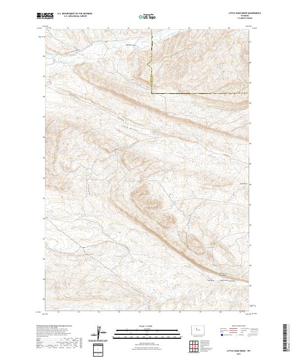
2021 Map of Little Sand Draw
USGS Topo · Published 2021About this map
Harris Spring and the braided drainage of Sand Draw define this high-desert landscape along the boundary of Hot Springs and Washakie counties. The terrain is deeply inscribed by a network of seasonal watercourses, including Coal Draw and its tributaries, the North Fork Coal Draw and South Fork Coal Draw. This 2021 survey illustrates a region largely shaped by its hydrology and the sparse road network required to navigate it.
Find a feature on this map
16 named features on this map. Tap any name to fly to it.
Don’t see what you’re looking for? This feature index may not catch every label — zoom into the map to look around manually.
Map Details
Editions of this 2021 Little Sand Draw Map
This is the sole edition of this map. No revisions or reprints were ever made.
Other maps of this area

1914 · Blue Mesa
USGS Topo · 1:62,500

1916 · Blue Mesa
USGS Topo · 1:62,500

1945 · Kirby
USGS Topo · 1:62,500

1946 · Kirby
USGS Topo · 1:62,500

1955 · Thermopolis
USGS Topo · 1:250,000

1958 · Thermopolis
USGS Topo · 1:250,000

1960 · Thermopolis
USGS Topo · 1:24,000

1962 · Thermopolis
USGS Topo · 1:250,000
1965 · Thompson Reservoirs
USGS Topo · 1:24,000
1965 · Rattlesnake Gulch
USGS Topo · 1:24,000