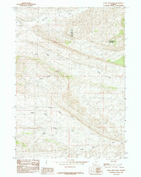
1985 Map of Little Sand Draw
USGS Topo · Published 1985About this map
Cottonwood Creek and Grass Creek define the northern drainage patterns of this high plains territory where the borders of Hot Springs and Washakie counties meet. The landscape is heavily marked by the erosive forces of seasonal water, carving out extensive ephemeral systems like Little Sand Draw and Coal Draw. These drainage networks provided critical landmarks and water sources for early navigation through the region.
Find a feature on this map
11 named features on this map. Tap any name to fly to it.
Don’t see what you’re looking for? This feature index may not catch every label — zoom into the map to look around manually.
Map Details
Editions of this 1985 Little Sand Draw Map
This is the sole edition of this map. No revisions or reprints were ever made.
Other maps of this area

1914 · Blue Mesa
USGS Topo · 1:62,500

1916 · Blue Mesa
USGS Topo · 1:62,500

1945 · Kirby
USGS Topo · 1:62,500

1946 · Kirby
USGS Topo · 1:62,500

1955 · Thermopolis
USGS Topo · 1:250,000

1958 · Thermopolis
USGS Topo · 1:250,000

1960 · Thermopolis
USGS Topo · 1:24,000

1962 · Thermopolis
USGS Topo · 1:250,000
1965 · Thompson Reservoirs
USGS Topo · 1:24,000
1965 · Rattlesnake Gulch
USGS Topo · 1:24,000