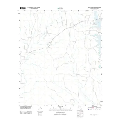
2012 Map of Little Sandy Creek
USGS Topo · Published 2012About this map
Vernon Lake defines the eastern boundary of this Vernon Parish landscape, where the wooded terrain is carved by a dense network of tributaries. The hydrology of the region is centered on the winding course of Little Sandy Creek and its many feeders, including Koonce Creek, Dogwood Branch, and Blue Creek. These waterways dictate the local geography, with roads often following the higher ground between creek beds. For those tracing local heritage, Beechgrove Cemetery serves as a significant landmark in the southwestern quadrant. The map reveals a transition from the established lakefront areas near Vernon Lake to the more interior forest lands accessed by routes like Camp Baker Trace. This 2012 survey illustrates the balance between natural water systems and the rural road network in central Louisiana.
Find a feature on this map
89 named features on this map. Tap any name to fly to it.
Don’t see what you’re looking for? This feature index may not catch every label — zoom into the map to look around manually.
Map Details
Editions of this 2012 Little Sandy Creek Map
This is the sole edition of this map. No revisions or reprints were ever made.
Other maps of this area

1941 · Leesville
USGS Topo · 1:62,500

1942 · Florien
USGS Topo · 1:62,500

1943 · Leesville
USGS Topo · 1:62,500

1944 · Negreet
USGS Topo · 1:62,500

1944 · Wiergate
USGS Topo · 1:62,500

1944 · Florien
USGS Topo · 1:62,500

1946 · Leesville
USGS Topo · 1:62,500

1948 · Leesville
USGS Topo · 1:62,500

1948 · Wiergate
USGS Topo · 1:62,500

1953 · Alexandria
USGS Topo · 1:250,000