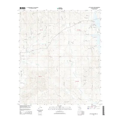
2015 Map of Little Sandy Creek
USGS Topo · Published 2015About this map
Little Sandy Creek and Sandy Cr define the drainage of this Vernon Parish landscape, where the terrain is marked by a complex network of named tributaries including Koonce Creek, Rocky Creek, and Brushy Creek. The settlement pattern in this part of Louisiana is largely defined by rural road loops and family-named landmarks. The historic Beechgrove Cem serves as a significant genealogical point of interest in the western portion of the quadrangle. Transport and access are tied to corridors like La-392 and several distinctive residential clusters such as Kirks Little Acre and Peaceful Pt. Throughout the area, the transition from wooded hills to creek bottoms is traced by numerous local routes including Wanda Gaskin Rd, Davis Rd, and Dowden Loop.
Find a feature on this map
83 named features on this map. Tap any name to fly to it.
Don’t see what you’re looking for? This feature index may not catch every label — zoom into the map to look around manually.
Map Details
Editions of this 2015 Little Sandy Creek Map
This is the sole edition of this map. No revisions or reprints were ever made.
Other maps of this area

1941 · Leesville
USGS Topo · 1:62,500

1942 · Florien
USGS Topo · 1:62,500

1943 · Leesville
USGS Topo · 1:62,500

1944 · Negreet
USGS Topo · 1:62,500

1944 · Wiergate
USGS Topo · 1:62,500

1944 · Florien
USGS Topo · 1:62,500

1946 · Leesville
USGS Topo · 1:62,500

1948 · Leesville
USGS Topo · 1:62,500

1948 · Wiergate
USGS Topo · 1:62,500

1953 · Alexandria
USGS Topo · 1:250,000