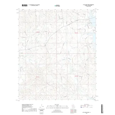
2018 Map of Little Sandy Creek
USGS Topo · Published 2018About this map
Beechgrove Cem sits on the western edge of this Vernon Parish landscape, which is defined by a dense network of tributaries feeding into the Anacoco watershed. The terrain is intricately carved by Sandy Cr, Little Sandy Cr, and Rocky Cr, creating a complex series of ridges and creek bottoms. This 2018 survey reveals a rural landscape interlaced with parish roads and private lanes like Good Hope Rd and Wanda Gaskin RD, many of which follow the contours of the local drainage basins. In the southeast corner, the map provides detail on the northern reaches of Anacoco Lake, including Empire Pt and Jurdon Cr. Settlement is sparse and focused along these road networks, with Kirks Little Acre appearing as one of the few named clusters in the piney woods of west-central Louisiana.
Find a feature on this map
64 named features on this map. Tap any name to fly to it.
Don’t see what you’re looking for? This feature index may not catch every label — zoom into the map to look around manually.
Map Details
Editions of this 2018 Little Sandy Creek Map
This is the sole edition of this map. No revisions or reprints were ever made.
Other maps of this area

1941 · Leesville
USGS Topo · 1:62,500

1942 · Florien
USGS Topo · 1:62,500

1943 · Leesville
USGS Topo · 1:62,500

1944 · Negreet
USGS Topo · 1:62,500

1944 · Wiergate
USGS Topo · 1:62,500

1944 · Florien
USGS Topo · 1:62,500

1946 · Leesville
USGS Topo · 1:62,500

1948 · Leesville
USGS Topo · 1:62,500

1948 · Wiergate
USGS Topo · 1:62,500

1953 · Alexandria
USGS Topo · 1:250,000