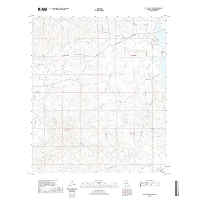
2020 Map of Little Sandy Creek
USGS Topo · Published 2020About this map
Beechgrove and the nearby Beechgrove Cem anchor the western portion of this Vernon Parish landscape, which is defined by a dense network of drainages feeding into the central and eastern basin. The terrain is deeply incised by Sandy Creek and the Little Sandy Creek, which converge amidst a web of secondary routes including Good Hope Road and Parish Road 97. This 2020 survey reveals a rural territory where local geography is marked by family-named landmarks and many small water bodies such as Dogwood Branch, Pearl Creek, and Coney Creek. In the northeast, the elevation rises toward Empire Pt, overlooking the wetlands that flank Jurdon Creek. The road network, featuring names like Trigger Trap Drive and Dowden Loop, suggests a pattern of modern residential expansion along old logging and agricultural corridors.
Find a feature on this map
66 named features on this map. Tap any name to fly to it.
Don’t see what you’re looking for? This feature index may not catch every label — zoom into the map to look around manually.
Map Details
Editions of this 2020 Little Sandy Creek Map
This is the sole edition of this map. No revisions or reprints were ever made.
Other maps of this area

1941 · Leesville
USGS Topo · 1:62,500

1942 · Florien
USGS Topo · 1:62,500

1943 · Leesville
USGS Topo · 1:62,500

1944 · Negreet
USGS Topo · 1:62,500

1944 · Wiergate
USGS Topo · 1:62,500

1944 · Florien
USGS Topo · 1:62,500

1946 · Leesville
USGS Topo · 1:62,500

1948 · Leesville
USGS Topo · 1:62,500

1948 · Wiergate
USGS Topo · 1:62,500

1953 · Alexandria
USGS Topo · 1:250,000