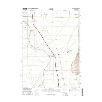
2015 Map of Little Sioux
USGS Topo · Published 2015About this map
The Missouri River floodplain defines the landscape of this 2015 survey, where the river serves as the natural boundary between Iowa and Nebraska. The settlement of Little Sioux remains the primary hub on the eastern side of the valley, positioned near the foot of the bluffs. The map provides significant detail for genealogists, marking family-connected sites such as Conyers Cemetery, Little Sioux Cemetery, and Ruffcorn Cemetery. Further inland, the drainage patterns of Crane Outlet and various ditches illustrate the agricultural management of the bottomlands between Harrison and Burt counties. The complex boundary lines highlight how the shifting course of the Missouri River has historically influenced legal jurisdictions along this riverine corridor.
Find a feature on this map
20 named features on this map. Tap any name to fly to it.
Don’t see what you’re looking for? This feature index may not catch every label — zoom into the map to look around manually.
Map Details
Editions of this 2015 Little Sioux Map
This is the sole edition of this map. No revisions or reprints were ever made.
Other maps of this area

1954 · Omaha
USGS Topo · 1:250,000

1955 · Fremont
USGS Topo · 1:250,000

1957 · Fremont
USGS Topo · 1:250,000

1957 · Omaha
USGS Topo · 1:250,000

1958 · Omaha
USGS Topo · 1:250,000

1958 · Fremont
USGS Topo · 1:250,000

1970 · Little Sioux
USGS Topo · 1:24,000
1970 · Tekamah NW
USGS Topo · 1:24,000
1970 · Blencoe
USGS Topo · 1:24,000

1970 · Herman
USGS Topo · 1:24,000