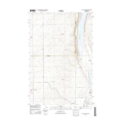
2014 Map of Little Soap Lake
USGS Topo · Published 2014About this map
The northern edge of Soap Lake serves as the focal point for this landscape, where the water's edge meets the residential streets and recreation areas of Lakeview Park. This high-desert terrain is defined by the geology of the Lower Grand Coulee, featuring a chain of water bodies including Lenore Lake, Little Soap Lake, and Dry Lake. The map illustrates a complex relationship between the natural topography of Sparks Canyon and Sheep Canyon and the engineered water systems represented by the Main Canal.
Find a feature on this map
35 named features on this map. Tap any name to fly to it.
Don’t see what you’re looking for? This feature index may not catch every label — zoom into the map to look around manually.
Map Details
Editions of this 2014 Little Soap Lake Map
This is the sole edition of this map. No revisions or reprints were ever made.
Other maps of this area

1953 · Ritzville
USGS Topo · 1:250,000

1956 · Ephrata
USGS Topo · 1:62,500

1956 · Ephrata
USGS Topo · 1:24,000

1956 · Ephrata SW
USGS Topo · 1:24,000

1956 · Grant Orchards
USGS Topo · 1:24,000

1956 · Soap Lake
USGS Topo · 1:24,000

1959 · Ritzville
USGS Topo · 1:250,000

1965 · Ritzville
USGS Topo · 1:250,000

1965 · Jameson Lake SW
USGS Topo · 1:24,000

1965 · Jameson Lake SE
USGS Topo · 1:24,000