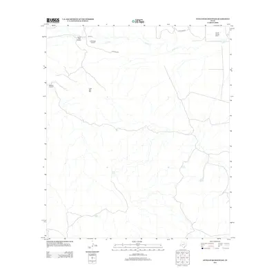
2012 Map of Little Star Mountain
USGS Topo · Published 2012About this map
Jeff Ranch serves as a primary human landmark in this section of Pecos County, where the landscape is defined by drainage patterns and seasonal water sources. The terrain is marked by named features like Horse Thief Canyon and Lochousen Canyon in the north, which feed toward the path of Limpia Cr. Further south, the presence of Indian Springs, Adobe Springs, and White Tanks suggests the critical importance of water management in this arid environment, providing necessary points of interest for those researching land use and ranching history. The eponymous Little Star Mtn stands as a central topographic feature, overlooking a network of draws including South Carrizo Draw. Access to this area remains centered on Limpia Creek Rd and Jeff Ranch Rd, reflecting long-established transit corridors through the canyon-cut hills.
Find a feature on this map
13 named features on this map. Tap any name to fly to it.
Don’t see what you’re looking for? This feature index may not catch every label — zoom into the map to look around manually.
Map Details
Editions of this 2012 Little Star Mountain Map
This is the sole edition of this map. No revisions or reprints were ever made.
Other maps of this area

1894 · Fort Davis
USGS Topo · 1:125,000

1897 · Fort Davis
USGS Topo · 1:125,000

1929 · Hovey
USGS Topo · 1:125,000

1954 · Fort Stockton
USGS Topo · 1:250,000

1958 · Fort Stockton
USGS Topo · 1:250,000

1970 · Deep Well Ranch
USGS Topo · 1:24,000

1973 · Fort Stockton
USGS Topo · 1:250,000
1980 · Henderson Mesa
USGS Topo · 1:24,000
1980 · Barrilla Mountains East
USGS Topo · 1:24,000
1980 · Hovey SW
USGS Topo · 1:24,000