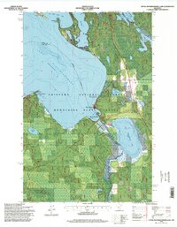
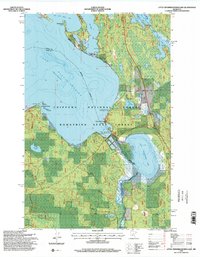
1996 Map of Little Winnibigoshish Lake
USGS Topo · Published 1998About this map
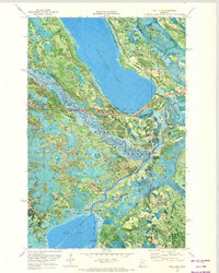
Winnie Dam controls the outflow of the Mississippi River as it leaves the expansive waters of Lake Winnibigoshish and enters Little Winnibigoshish Lake. This northern Minnesota landscape is defined by its complex shoreline, characterized by prominent features like Sugarbush Point, Battle Point, and Plug Hat Point. Most of the terrain is protected within the overlapping boundaries of the Chippewa National Forest and the Bowstring State Forest, maintaining a character focused on resource management and water access.
Find a feature on this map
19 named features on this map. Tap any name to fly to it.
Don’t see what you’re looking for? This feature index may not catch every label — zoom into the map to look around manually.
Map Details
Editions of this 1996 Little Winnibigoshish Lake Map
2 editions found
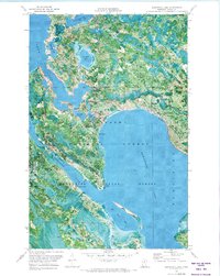
Other maps of this area
1919 · Max
USGS Topo · 1:62,500

1954 · Bemidji
USGS Topo · 1:250,000

1954 · Hibbing
USGS Topo · 1:250,000

1957 · Bemidji
USGS Topo · 1:250,000

1957 · Hibbing
USGS Topo · 1:250,000

1958 · Bemidji
USGS Topo · 1:250,000

1958 · Hibbing
USGS Topo · 1:250,000

1964 · Hibbing
USGS Topo · 1:250,000
1970 · Bowstring Lake
USGS Topo · 1:24,000
1970 · Ball Club
USGS Topo · 1:24,000