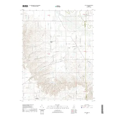
2019 Map of Little York
USGS Topo · Published 2019About this map
Little York serves as a central hub in this southern Indiana landscape, where the agricultural flats of the north meet the more dissected, hollow-carved terrain to the south. The northern portion of the map is defined by drainage systems like the Muscatatuck River and Cammie Thomas Ditch, supporting rural settlements such as Pumpkin Center. Further south, the topography shifts significantly as the Knobstone Trail winds through a series of deeply etched drainages including Rutherford Hollow, Shantaky Hollow, and Dowling Hollow. This transition is marked by prominent high points like Vic Swaim Hill, providing a clear view of how the area's geography influenced the placement of early communities like New Philadelphia. Family history is preserved in sites such as Steep Hollow Cem and Riden Cem, while the Little York Airport indicates the modern utility of these rural Indiana uplands.
Find a feature on this map
89 named features on this map. Tap any name to fly to it.
Don’t see what you’re looking for? This feature index may not catch every label — zoom into the map to look around manually.
Map Details
Editions of this 2019 Little York Map
This is the sole edition of this map. No revisions or reprints were ever made.
Other maps of this area

1947 · Scottsburg
USGS Topo · 1:24,000

1949 · Henryville
USGS Topo · 1:24,000

1950 · Salem
USGS Topo · 1:24,000

1953 · Kossuth
USGS Topo · 1:24,000

1955 · South Boston
USGS Topo · 1:24,000

1956 · Vincennes
USGS Topo · 1:250,000

1956 · Louisville
USGS Topo · 1:250,000

1957 · Vincennes
USGS Topo · 1:250,000

1958 · Vincennes
USGS Topo · 1:250,000

1958 · Little York
USGS Topo · 1:24,000