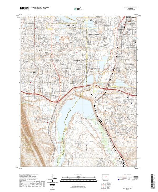
2022 Map of Littleton
USGS Topo · Published 2022About this map
Chatfield Lake dominates the southern landscape of this Colorado corridor, where the South Platte River and an intricate network of irrigation ditches historically defined the valley's development. This modern survey illustrates the transition from the concentrated urban core of Littleton and Englewood toward the residential expanses of Columbine and Ken Caryl. Educational and civic anchors such as Arapahoe Community College, Denver Seminary, and the Arapahoe County Courthouse stand as central landmarks near the river.
Find a feature on this map
90 named features on this map. Tap any name to fly to it.
Don’t see what you’re looking for? This feature index may not catch every label — zoom into the map to look around manually.
Map Details
Editions of this 2022 Littleton Map
This is the sole edition of this map. No revisions or reprints were ever made.
Other maps of this area

1890 · East Denver
USGS Topo · 1:125,000

1893 · Platte Canyon
USGS Topo · 1:125,000

1894 · Castle Rock
USGS Topo · 1:125,000

1899 · West Denver
USGS Topo · 1:125,000

1913 · Castle Rock
USGS Topo · 1:125,000

1935 · East Denver Nos. 3 and 4
USGS Topo · 1:48,000

1938 · Morrison
USGS Topo · 1:24,000

1940 · Englewood
USGS Topo · 1:31,680

1940 · Castle Rock
USGS Topo · 1:62,500

1941 · Fort Logan
USGS Topo · 1:31,680