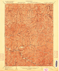
1905 Map of Littleton
USGS Topo · Published 1916About this map
Fishing Creek and its many winding tributaries like Hartley Run and Honey Creek carve through the deep ridges of Wetzel County in the years following the turn of the century. The Baltimore and Ohio railroad corridor provides a vital transportation link in the northeast, connecting the settlement of Littleton to the surrounding hills. This survey records a dense network of upland communities and post offices, such as Mohr P.O. Barker and Silver Hill, which were then active hubs for the local rural population. The landscape is defined by its extreme relief, where narrow valley floors host hamlets like Wileyville and Halls Mills while high points like Owlshead and Springhill watch over the complex drainage patterns of the Marshall and Greene county borderlands.
Find a feature on this map
112 named features on this map. Tap any name to fly to it.
Don’t see what you’re looking for? This feature index may not catch every label — zoom into the map to look around manually.
Map Details
Editions of this 1905 Littleton Map
2 editions found
Other maps of this area

1902 · Clarksburg
USGS Topo · 1:62,500

1903 · Littleton
USGS Topo · 1:62,500

1904 · Cameron
USGS Topo · 1:62,500

1905 · Mannington
USGS Topo · 1:62,500

1905 · Rogersville
USGS Topo · 1:62,500

1905 · Centerpoint
USGS Topo · 1:62,500

1905 · West Union
USGS Topo · 1:62,500

1905 · Littleton
USGS Topo · 1:62,500

1905 · Clarington
USGS Topo · 1:62,500

1906 · New Martinsville
USGS Topo · 1:62,500