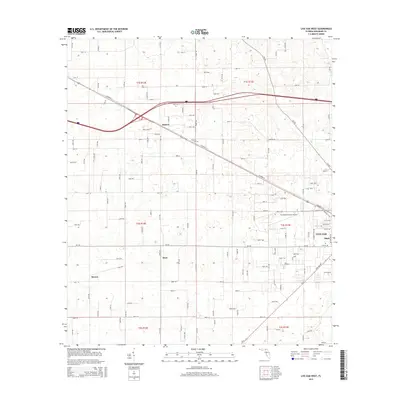
2015 Map of Live Oak West
USGS Topo · Published 2015About this map
Live Oak anchor the eastern edge of this landscape, situated at the crossroads of regional transit lines and local thoroughfares. The terrain is marked by the presence of the Suwannee County Airport and the historic Rock Cut Cem, reflecting the area's development as an aviation and community hub. A dense grid of rural roads, including 181st Rd and Garrison Rd, connects small outlying settlements such as Dickert, Starr, Mercer, and Slade. The layout of the land shows a clear transition from the organized street grid of the town center to the expansive agricultural and wooded parcels defined by the Public Land Survey System, including sectors like t2s r13e. The prominent corridor of Railroad St provides a physical link to the region's transport history, cutting diagonally through the northern part of the county near the Dickert junction.
Find a feature on this map
113 named features on this map. Tap any name to fly to it.
Don’t see what you’re looking for? This feature index may not catch every label — zoom into the map to look around manually.
Map Details
Editions of this 2015 Live Oak West Map
This is the sole edition of this map. No revisions or reprints were ever made.
Other maps of this area

1954 · Dowling Park
USGS Topo · 1:24,000

1954 · Valdosta
USGS Topo · 1:250,000

1955 · Mayo NE
USGS Topo · 1:24,000

1958 · Valdosta
USGS Topo · 1:250,000

1958 · Fort Union
USGS Topo · 1:24,000

1959 · Valdosta
USGS Topo · 1:250,000

1959 · Ellaville
USGS Topo · 1:24,000

1959 · Live Oak West
USGS Topo · 1:24,000

1959 · Falmouth
USGS Topo · 1:24,000

1961 · Live Oak East
USGS Topo · 1:24,000