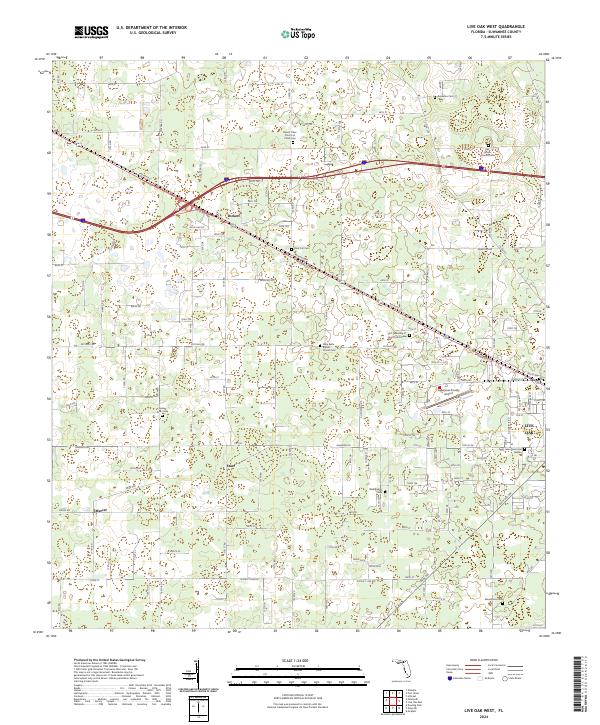
2024 Map of Live Oak West
USGS Topo · Published 2024About this map
Live Oak serves as the eastern anchor for this landscape, where the Suwannee County Airport marks the transition between the developed town and the surrounding agricultural countryside. The map reveals a dense network of local routes such as Howard St W and W Co Rd 10A, which connect several small communities including Dickert, Starr, and Mercer. These settlements are often defined by their proximity to historic crossroads and community institutions.
Find a feature on this map
118 named features on this map. Tap any name to fly to it.
Don’t see what you’re looking for? This feature index may not catch every label — zoom into the map to look around manually.
Map Details
Editions of this 2024 Live Oak West Map
This is the sole edition of this map. No revisions or reprints were ever made.
Other maps of this area

1954 · Dowling Park
USGS Topo · 1:24,000

1954 · Valdosta
USGS Topo · 1:250,000

1955 · Mayo NE
USGS Topo · 1:24,000

1958 · Valdosta
USGS Topo · 1:250,000

1958 · Fort Union
USGS Topo · 1:24,000

1959 · Valdosta
USGS Topo · 1:250,000

1959 · Ellaville
USGS Topo · 1:24,000

1959 · Live Oak West
USGS Topo · 1:24,000

1959 · Falmouth
USGS Topo · 1:24,000

1961 · Live Oak East
USGS Topo · 1:24,000