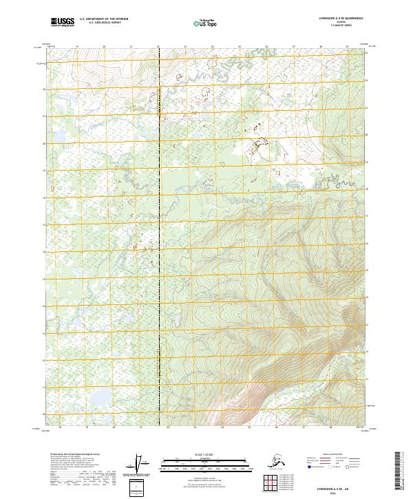
2024 Map of Livengood A-4 SE
USGS Topo · Published 2024About this map
Tatalina River and Washington Creek wind through the vast wetlands and interior lowlands of the Fairbanks North Star Borough and Yukon-Koyukuk Census Area. This topographic study reveals a landscape defined by complex river systems and undulating terrain, where the northern slopes give way to the prominent flow of the Chatanika River in the south. The area is characterized by its relative isolation and the natural drainage patterns of these critical Alaskan waterways. The lack of established settlements or transport infrastructure emphasizes the wild nature of this corridor northwest of Fairbanks, providing a clear record of the hydrography and elevation before any modern development might alter the drainage basins of these tributary systems.
Find a feature on this map
9 named features on this map. Tap any name to fly to it.
Don’t see what you’re looking for? This feature index may not catch every label — zoom into the map to look around manually.
Map Details
Editions of this 2024 Livengood A-4 SE Map
This is the sole edition of this map. No revisions or reprints were ever made.
Other maps of this area

1945 · Livengood
USGS Topo · 1:250,000

1949 · Fairbanks D-3
USGS Topo · 1:63,360

1949 · Fairbanks D-4
USGS Topo · 1:63,360

1950 · Fairbanks
USGS Topo · 1:250,000

1950 · Fairbanks D-3
USGS Topo · 1:63,360

1951 · Fairbanks
USGS Topo · 1:250,000

1951 · Livengood
USGS Topo · 1:250,000

1951 · Livengood A-4
USGS Topo · 1:63,360

1952 · Fairbanks D-3
USGS Topo · 1:63,360

1952 · Fairbanks D-4
USGS Topo · 1:63,360