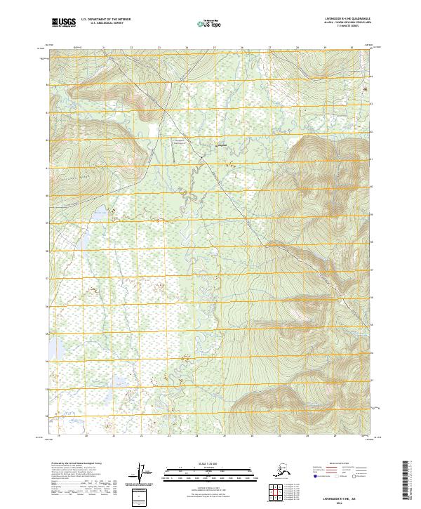
2024 Map of Livengood B-4 NE
USGS Topo · Published 2024About this map
Livengood serves as a central hub in this interior Alaskan corridor, positioned where essential infrastructure meets the wilderness. The settlement is defined by its proximity to major transportation arteries, including the Dalton Highway and the Elliott Highway, which facilitate movement through the Yukon-Koyukuk region. A defining industrial landmark is the Alaska Pipeline, which traverses the terrain from the northwest to the southeast, cutting across the drainages of Livengood Creek and Shorty Creek. The hydrology is dominated by the meandering Tolovana River and its West Fork, which wind through the lowlands south of Cascaden Ridge. Small aviation access is noted at the Livengood Camp Airport, reflecting the logistical requirements of this remote mining and transportation district. The map captures a landscape where modern energy infrastructure and historic transit routes follow the natural contours of valleys like Ranney Hollow and Olive Creek.
Find a feature on this map
24 named features on this map. Tap any name to fly to it.
Don’t see what you’re looking for? This feature index may not catch every label — zoom into the map to look around manually.
Map Details
Editions of this 2024 Livengood B-4 NE Map
This is the sole edition of this map. No revisions or reprints were ever made.
Other maps of this area

1945 · Livengood
USGS Topo · 1:250,000

1951 · Livengood
USGS Topo · 1:250,000

1952 · Livengood C-4
USGS Topo · 1:63,360

1953 · Livengood B-4
USGS Topo · 1:63,360

1954 · Livengood B-3
USGS Topo · 1:63,360

1954 · Livengood C-4
USGS Topo · 1:63,360
1954 · Livengood C-3
USGS Topo · 1:63,360

1956 · Livengood
USGS Topo · 1:250,000

1964 · Livengood
USGS Topo · 1:250,000
2017 · Livengood B-4 SW
USGS Topo · 1:25,000