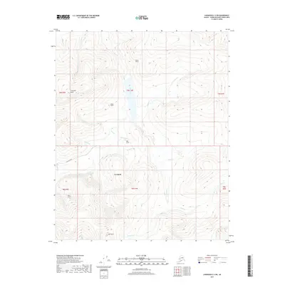
2017 Map of Livengood C-3 SW
USGS Topo · Published 2017About this map
Livengood serves as the central hub of this interior Alaska landscape, situated where Livengood Road meets the valley floor. The settlement is defined by its placement between the high ground of Livengood Dome to the northwest and Amy Dome to the south. The drainage pattern revealed here is dense with gold-mining history, as evidenced by the numerous named gulches and creeks that feed into the larger water systems. To the north, Helen Gulch and Snow Gulch descend toward the valley, while May Gulch and Glen Gulch flank the main settlement area.
Find a feature on this map
31 named features on this map. Tap any name to fly to it.
Don’t see what you’re looking for? This feature index may not catch every label — zoom into the map to look around manually.
Map Details
Editions of this 2017 Livengood C-3 SW Map
This is the sole edition of this map. No revisions or reprints were ever made.
Other maps of this area

1945 · Livengood
USGS Topo · 1:250,000

1951 · Livengood
USGS Topo · 1:250,000

1952 · Livengood C-4
USGS Topo · 1:63,360

1953 · Livengood B-4
USGS Topo · 1:63,360

1954 · Livengood B-3
USGS Topo · 1:63,360

1954 · Livengood C-4
USGS Topo · 1:63,360
1954 · Livengood C-3
USGS Topo · 1:63,360

1956 · Livengood
USGS Topo · 1:250,000

1964 · Livengood
USGS Topo · 1:250,000
2017 · Livengood C-4 SE
USGS Topo · 1:25,000