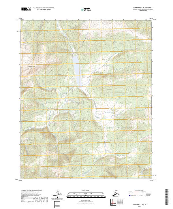
2024 Map of Livengood C-3 SW
USGS Topo · Published 2024About this map
The settlement of Livengood serves as the focal point of this interior Alaska survey, situated along the Livengood Road in a landscape defined by significant topographic rises. To the west, Livengood Dome stands as a prominent landmark, while Amy Dome anchors the southern portion of the quadrangle. The area is characterized by a dense network of watercourses that have historically shaped local movement and land use, including the South Fork Hess Creek and Livengood Creek. Numerous smaller drainages such as Alabam Creek, Goldstream Creek, and Martin Creek cut through the terrain, alongside smaller gulches like Helen Gulch and May Gulch. This map provides a detailed view of the contemporary infrastructure and hydrological patterns of this northern region, illustrating the relationship between the few established roads and the complex stream systems that define the Yukon-Koyukuk territory.
Find a feature on this map
31 named features on this map. Tap any name to fly to it.
Don’t see what you’re looking for? This feature index may not catch every label — zoom into the map to look around manually.
Map Details
Editions of this 2024 Livengood C-3 SW Map
This is the sole edition of this map. No revisions or reprints were ever made.
Other maps of this area

1945 · Livengood
USGS Topo · 1:250,000

1951 · Livengood
USGS Topo · 1:250,000

1952 · Livengood C-4
USGS Topo · 1:63,360

1953 · Livengood B-4
USGS Topo · 1:63,360

1954 · Livengood B-3
USGS Topo · 1:63,360

1954 · Livengood C-4
USGS Topo · 1:63,360
1954 · Livengood C-3
USGS Topo · 1:63,360

1956 · Livengood
USGS Topo · 1:250,000

1964 · Livengood
USGS Topo · 1:250,000
2017 · Livengood C-4 SE
USGS Topo · 1:25,000