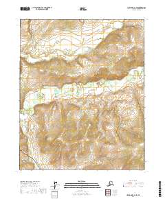
2017 Map of Livengood C-4 NW
USGS Topo · Published 2017About this map
The Alaska Pipeline cuts a distinct path through this interior landscape, marking a modern industrial corridor across the remote Yukon-Koyukuk region. In this high-latitude terrain, the natural drainage patterns of Hess Cr and its tributaries, including Fish Cr and Erickson Cr, dictate the movement through the valleys between significant elevation gains. The map provides a detailed view of the interaction between large-scale engineering and subarctic hydrology, where the massive energy conduit traverses a complex network of seasonal and permanent waterways. This 2017 survey reflects the contemporary state of the Trans-Alaska Pipeline System corridor, showcasing the topographical challenges faced by infrastructure in the Alaskan interior.
Find a feature on this map
10 named features on this map. Tap any name to fly to it.
Don’t see what you’re looking for? This feature index may not catch every label — zoom into the map to look around manually.
Map Details
Editions of this 2017 Livengood C-4 NW Map
This is the sole edition of this map. No revisions or reprints were ever made.
Other maps of this area

1945 · Livengood
USGS Topo · 1:250,000

1951 · Livengood
USGS Topo · 1:250,000

1952 · Livengood C-5
USGS Topo · 1:63,360

1952 · Livengood D-5
USGS Topo · 1:63,360

1952 · Livengood C-4
USGS Topo · 1:63,360

1953 · Livengood D-4
USGS Topo · 1:63,360

1954 · Livengood D-4
USGS Topo · 1:63,360

1954 · Livengood C-4
USGS Topo · 1:63,360

1956 · Livengood
USGS Topo · 1:250,000

1964 · Livengood
USGS Topo · 1:250,000