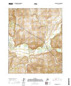
2017 Map of Livengood C-5 NE
USGS Topo · Published 2017About this map
The Alaska Pipeline and the Dalton Highway dominate the interior landscape of the Yukon-Koyukuk region, following a similar north-south path through this wilderness. This corridor represents the critical infrastructure of the late 20th and early 21st centuries, providing access to the North Slope. The terrain is defined by a series of drainage basins, most notably Hess Cr which flows westward across the southern half of the map. Its tributaries, including Richardson Cr and Mastodon Cr to the north, create a complex network of valleys and ridges. The map illustrates the specialized relationship between industrial engineering and the subarctic environment, where the pipeline is carefully routed through specific topographic passes to maintain its integrity across the varying elevations.
Find a feature on this map
11 named features on this map. Tap any name to fly to it.
Don’t see what you’re looking for? This feature index may not catch every label — zoom into the map to look around manually.
Map Details
Editions of this 2017 Livengood C-5 NE Map
This is the sole edition of this map. No revisions or reprints were ever made.
Other maps of this area

1945 · Livengood
USGS Topo · 1:250,000

1951 · Livengood
USGS Topo · 1:250,000

1952 · Livengood C-5
USGS Topo · 1:63,360

1952 · Livengood D-5
USGS Topo · 1:63,360

1952 · Livengood C-4
USGS Topo · 1:63,360

1953 · Livengood D-4
USGS Topo · 1:63,360

1954 · Livengood D-4
USGS Topo · 1:63,360

1954 · Livengood C-4
USGS Topo · 1:63,360

1956 · Livengood
USGS Topo · 1:250,000

1964 · Livengood
USGS Topo · 1:250,000