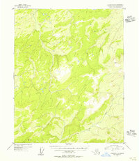
1954 Map of Livengood D-3
USGS Topo · Published 1956About this map
North Fork Hess Creek carves a deep valley through this interior landscape, which was mapped via aerial photography in the early 1950s. The topography is defined by high ridgelines and survey stations such as VABM Kermit and VABM North, which served as critical control points for the Geological Survey's mapping efforts in the Fourth Judicial Division. This sheet depicts the drainage patterns and elevation contours of a region without established roads or settlements at the time of the survey, focusing instead on the hydrography of the North Fork Hess Creek watershed and the specific elevation peaks that guided territorial explorers and surveyors.
Find a feature on this map
3 named features on this map. Tap any name to fly to it.
Don’t see what you’re looking for? This feature index may not catch every label — zoom into the map to look around manually.
Map Details
Editions of this 1954 Livengood D-3 Map
This is the sole edition of this map. No revisions or reprints were ever made.
Other maps of this area

1945 · Livengood
USGS Topo · 1:250,000

1951 · Livengood
USGS Topo · 1:250,000

1951 · Beaver
USGS Topo · 1:250,000

1951 · Livengood D-3
USGS Topo · 1:63,360

1951 · Livengood C-2
USGS Topo · 1:63,360

1952 · Livengood C-4
USGS Topo · 1:63,360

1952 · Livengood D-2
USGS Topo · 1:63,360

1953 · Livengood D-4
USGS Topo · 1:63,360

1954 · Livengood C-2
USGS Topo · 1:63,360

1954 · Livengood D-4
USGS Topo · 1:63,360