
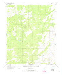
1951 Map of Livengood D-3
USGS Topo · Published 1968About this map
Hess Creek and the North Fork dominate the lower portions of this 1950s interior Alaska landscape, reflecting a drainage system largely unimpacted by permanent settlement. The survey, derived from 1951 aerial photography, documents a terrain where high ridges are defined by geodetic markers like VABM 2452 Kermit and VABM 2207 North. The absence of roads or established townships underscores the wilderness character of the region during the early Cold War era, when the Bureau of Land Management was predetermining land lines across unsurveyed tracts. Waterways such as Alfred Creek and Butte Creek provide the primary geographical orientation in an area otherwise defined by its topographic elevation and natural drainage patterns.
Find a feature on this map
6 named features on this map. Tap any name to fly to it.
Don’t see what you’re looking for? This feature index may not catch every label — zoom into the map to look around manually.
Map Details
Editions of this 1951 Livengood D-3 Map
2 editions found
Other maps of this area

1945 · Livengood
USGS Topo · 1:250,000

1951 · Livengood
USGS Topo · 1:250,000

1951 · Beaver
USGS Topo · 1:250,000

1951 · Livengood C-2
USGS Topo · 1:63,360

1952 · Livengood C-4
USGS Topo · 1:63,360

1952 · Livengood D-2
USGS Topo · 1:63,360

1953 · Livengood D-4
USGS Topo · 1:63,360

1954 · Livengood C-2
USGS Topo · 1:63,360

1954 · Livengood D-4
USGS Topo · 1:63,360
1954 · Livengood D-2
USGS Topo · 1:63,360