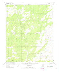
1951 Map of Livengood D-3
USGS Topo · Published 1974About this map
Hess Creek and its major tributary, the North Fork Hess Creek, dominate the drainage patterns of this sub-arctic landscape. This 1951 aerial photogrammetric survey reveals an undeveloped interior wilderness, where watercourses like Alfred Creek dictate the contours of the land. The presence of triangulation stations, specifically VABM Kermit and VABM North, suggests the necessity of elevated benchmarks for surveying this remote portion of the Alaskan interior. These markers served as the primary reference points for mapping the interior before the widespread use of satellite-based positioning. The map captures the territory as it existed prior to significant road development, showing only the natural hydrologic network and the high peaks that defined the early twentieth-century Alaskan frontier.
Find a feature on this map
5 named features on this map. Tap any name to fly to it.
Don’t see what you’re looking for? This feature index may not catch every label — zoom into the map to look around manually.
Map Details
Editions of this 1951 Livengood D-3 Map
2 editions found
Other maps of this area

1945 · Livengood
USGS Topo · 1:250,000

1951 · Livengood
USGS Topo · 1:250,000

1951 · Beaver
USGS Topo · 1:250,000

1951 · Livengood D-3
USGS Topo · 1:63,360

1951 · Livengood C-2
USGS Topo · 1:63,360

1952 · Livengood C-4
USGS Topo · 1:63,360

1952 · Livengood D-2
USGS Topo · 1:63,360

1953 · Livengood D-4
USGS Topo · 1:63,360

1954 · Livengood C-2
USGS Topo · 1:63,360

1954 · Livengood D-4
USGS Topo · 1:63,360