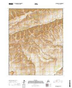
2017 Map of Livengood D-4 SW
USGS Topo · Published 2017About this map
The interior landscape of the t12n r6w and t12n r7w townships reveals a high-elevation Alaskan wilderness where seasonal watercourses carve through the terrain. The northern reaches are defined by the headwaters of Rogers Cr, which flows eastward toward the boundary of the neighboring range. To the west, the drainage of Waldron Cr marks the slopes, while the southeastern corner is intersected by the winding path of Fish Cr. This 2017 survey by the U.S. Geological Survey captures a sparsely labeled environment where the primary identifiers are the township and range lines of the Public Land Survey System, illustrating a vast region primarily used for resource management or wilderness preservation rather than settlement.
Find a feature on this map
7 named features on this map. Tap any name to fly to it.
Don’t see what you’re looking for? This feature index may not catch every label — zoom into the map to look around manually.
Map Details
Editions of this 2017 Livengood D-4 SW Map
This is the sole edition of this map. No revisions or reprints were ever made.
Other maps of this area

1945 · Livengood
USGS Topo · 1:250,000

1951 · Livengood
USGS Topo · 1:250,000

1952 · Livengood C-5
USGS Topo · 1:63,360

1952 · Livengood D-5
USGS Topo · 1:63,360

1952 · Livengood C-4
USGS Topo · 1:63,360

1953 · Livengood D-4
USGS Topo · 1:63,360

1954 · Livengood D-4
USGS Topo · 1:63,360

1954 · Livengood C-4
USGS Topo · 1:63,360

1956 · Livengood
USGS Topo · 1:250,000

1964 · Livengood
USGS Topo · 1:250,000