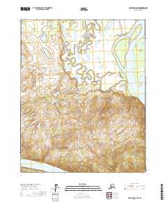
2017 Map of Livengood D-5 NW
USGS Topo · Published 2017About this map
Fort Hamlin Hills dominate the central landscape of this interior Alaska quadrangle, showing the elevation gain north of the winding Yukon River. This 2017 survey captures a remote wilderness environment where the Little Dall River meanders through a complex network of wetlands and oxbow lakes before approaching the main river channel. The hydrology here is remarkably intricate, particularly in the northern sections where the Little Dall River creates a maze of water within the low-lying terrain. Near the eastern boundary, the massive Yukon River flows past Chetlechak Island, illustrating the scale of this subarctic waterway. This map is a critical resource for understanding the contemporary topography of the Yukon-Koyukuk region, tracing the intersection of high ground and the shifting river systems that define the Alaskan interior.
Find a feature on this map
10 named features on this map. Tap any name to fly to it.
Don’t see what you’re looking for? This feature index may not catch every label — zoom into the map to look around manually.
Map Details
Editions of this 2017 Livengood D-5 NW Map
This is the sole edition of this map. No revisions or reprints were ever made.
Other maps of this area

1945 · Livengood
USGS Topo · 1:250,000

1951 · Livengood
USGS Topo · 1:250,000

1951 · Beaver
USGS Topo · 1:250,000

1952 · Livengood D-5
USGS Topo · 1:63,360

1956 · Beaver A-5
USGS Topo · 1:63,360

1956 · Beaver
USGS Topo · 1:250,000

1956 · Livengood D-6
USGS Topo · 1:63,360

1956 · Livengood
USGS Topo · 1:250,000

1964 · Beaver
USGS Topo · 1:250,000

1964 · Livengood
USGS Topo · 1:250,000