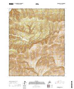
2017 Map of Livengood D-5 SE
USGS Topo · Published 2017About this map
Hamlin Cr and Waldron Cr define the drainage patterns of this upland terrain in the Yukon-Koyukuk region. The landscape is characterized by its isolation and the steep relief between the headwaters of Mastodon Cr and the surrounding ridges. Without established roads or settlements, the area remains a study in pristine wilderness where topographic contours tell the story of the land. Surveyed segments of Township 12 North, Range 8 West and its neighbors show the systematic grid applied to this undeveloped Alaskan interior. The map focuses on the natural hydrology and the significant elevation changes that govern the local geography, providing a clear view of the creek systems that eventually contribute to the larger regional watershed.
Find a feature on this map
7 named features on this map. Tap any name to fly to it.
Don’t see what you’re looking for? This feature index may not catch every label — zoom into the map to look around manually.
Map Details
Editions of this 2017 Livengood D-5 SE Map
This is the sole edition of this map. No revisions or reprints were ever made.
Other maps of this area

1945 · Livengood
USGS Topo · 1:250,000

1951 · Livengood
USGS Topo · 1:250,000

1952 · Livengood C-5
USGS Topo · 1:63,360

1952 · Livengood D-5
USGS Topo · 1:63,360

1952 · Livengood C-4
USGS Topo · 1:63,360

1953 · Livengood D-4
USGS Topo · 1:63,360

1954 · Livengood D-4
USGS Topo · 1:63,360

1954 · Livengood C-4
USGS Topo · 1:63,360

1956 · Livengood
USGS Topo · 1:250,000

1964 · Livengood
USGS Topo · 1:250,000