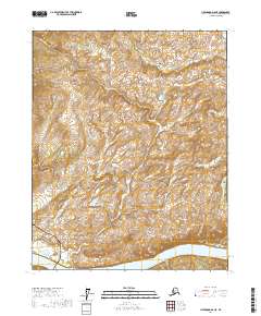
2017 Map of Livengood D-6 NE
USGS Topo · Published 2017About this map
The Yukon River cuts across the southern reach of this landscape, serving as a primary geographic anchor in the Yukon-Koyukuk region. In the southwest corner, modern infrastructure intersects the wilderness where the Dalton Highway and the Alaska Pipeline run parallel through the terrain. These corridors represent critical transportation and energy arteries for the state, carved into a topography defined by the Fort Hamlin Hills to the north and the prominence of Smoothface Mtn. Drainage patterns are visible through seasonal flows like Woodcamp Cr, which meanders through the central interior. This 2017 survey reflects the enduring spatial relationship between the massive scale of the northern interior and the concentrated industrial footprints required to navigate and utilize it.
Find a feature on this map
13 named features on this map. Tap any name to fly to it.
Don’t see what you’re looking for? This feature index may not catch every label — zoom into the map to look around manually.
Map Details
Editions of this 2017 Livengood D-6 NE Map
This is the sole edition of this map. No revisions or reprints were ever made.
Other maps of this area

1945 · Livengood
USGS Topo · 1:250,000

1951 · Livengood
USGS Topo · 1:250,000

1951 · Beaver
USGS Topo · 1:250,000

1952 · Livengood D-5
USGS Topo · 1:63,360

1956 · Beaver A-5
USGS Topo · 1:63,360

1956 · Beaver
USGS Topo · 1:250,000

1956 · Livengood D-6
USGS Topo · 1:63,360

1956 · Livengood
USGS Topo · 1:250,000

1964 · Beaver
USGS Topo · 1:250,000

1964 · Livengood
USGS Topo · 1:250,000