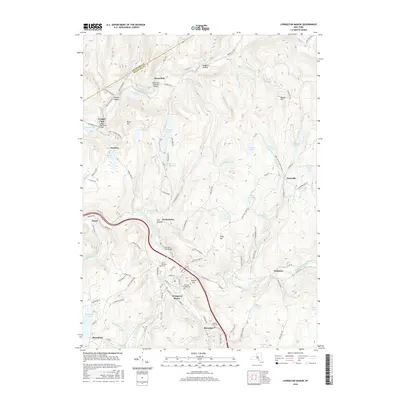
2016 Map of Livingston Manor
USGS Topo · Published 2016About this map
Livingston Manor serves as the primary hub of this Catskill region, situated at the confluence of the Willowemoc Creek and the Little Beaver Kill. The settlement pattern reflects a classic resort and mountain community layout, with clustered developments like Morsston and Parkston following the winding valley floor. Historical infrastructure remains visible through preserved crossings such as the Beaverkill Covered Bridge near the Beaverkill settlement and the Van Tran Flat Bridge further downstream.
Find a feature on this map
115 named features on this map. Tap any name to fly to it.
Don’t see what you’re looking for? This feature index may not catch every label — zoom into the map to look around manually.
Map Details
Editions of this 2016 Livingston Manor Map
This is the sole edition of this map. No revisions or reprints were ever made.
Other maps of this area

1901 · Margaretville
USGS Topo · 1:62,500

1904 · Margaretville
USGS Topo · 1:62,500

1910 · Neversink
USGS Topo · 1:62,500

1921 · Livingston Manor
USGS Topo · 1:62,500

1922 · Andes
USGS Topo · 1:62,500

1923 · Livingston Manor
USGS Topo · 1:62,500

1924 · Andes
USGS Topo · 1:62,500

1942 · Neversink
USGS Topo · 1:62,500

1943 · Monticello
USGS Topo · 1:125,000

1944 · Livingston Manor
USGS Topo · 1:62,500