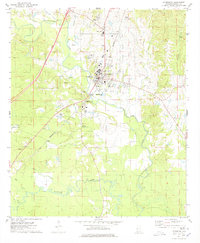
1974 Map of Livingston
USGS Topo · Published 1978About this map
The Livingston area serves as a primary hub of education and transport in western Alabama, centered on the campus of Livingston University. The Sucarnoochee River and Alamuchee Creek drain the surrounding landscape, which is marked by a network of smaller tributaries like Whiterock Creek and Yellow Creek. This survey captures the town's social fabric through its numerous community landmarks, including the County Training Sch and several recreational spaces such as Livingston Park and the Livingston Memorial Gardens.
Find a feature on this map
35 named features on this map. Tap any name to fly to it.
Don’t see what you’re looking for? This feature index may not catch every label — zoom into the map to look around manually.
Map Details
Editions of this 1974 Livingston Map
2 editions found
Other maps of this area

1929 · Epes
USGS Topo · 1:48,000

1932 · Epes
USGS Topo · 1:62,500

1953 · Meridian
USGS Topo · 1:250,000

1957 · Meridian
USGS Topo · 1:250,000

1965 · Meridian
USGS Topo · 1:250,000

1971 · Coatopa
USGS Topo · 1:24,000

1971 · Bellamy
USGS Topo · 1:24,000

1974 · Boyd
USGS Topo · 1:24,000
1974 · Epes West
USGS Topo · 1:24,000
1974 · Epes East
USGS Topo · 1:24,000