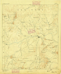
1955 Map of Llano
USGS Topo · Published 1955This historical map portrays the area of Llano in 1955, primarily covering Llano County as well as portions of Burnet, Travis County, Menard County, Edwards County, Kendall County, Williamson County, Hays County, Blanco County, Comal County, Gillespie County, McCulloch County, San Saba County, Kimble County, Mason County, Kerr County, and Real County. Featuring a scale of 1:250000, this map provides a highly detailed snapshot of the terrain, roads, buildings, counties, and historical landmarks in the Llano region at the time. Published in 1955, it is the sole known edition of this map.
Find a feature on this map
81 named features on this map. Tap any name to fly to it.
Don’t see what you’re looking for? This feature index may not catch every label — zoom into the map to look around manually.
Map Details
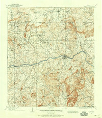
Editions of this 1955 Llano Map
This is the sole edition of this map. No revisions or reprints were ever made.
Historical Maps of Lakeway Through Time
10 maps found