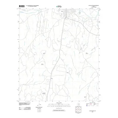
2010 Map of Llano South
USGS Topo · Published 2010About this map
The Llano River and its northern bank define the township of Llano, which serves as a central hub for the surrounding Texas hill country landscape. Extending south from the river, the terrain is marked by a series of prominent rises and drainage systems, including Oatman Creek and Flag Creek. Notable summits such as Hickory Mountain, Bachelor Peak, and Yearlinghead Mountain dominate the southern topography, providing distinct landmarks for local navigation.
Find a feature on this map
36 named features on this map. Tap any name to fly to it.
Don’t see what you’re looking for? This feature index may not catch every label — zoom into the map to look around manually.
Map Details
Editions of this 2010 Llano South Map
This is the sole edition of this map. No revisions or reprints were ever made.
Other maps of this area

1887 · Llano
USGS Topo · 1:125,000

1894 · Llano
USGS Topo · 1:125,000

1904 · Llano
USGS Topo · 1:125,000

1909 · Llano
USGS Topo · 1:125,000

1918 · Llano
USGS Topo · 1:125,000

1954 · Llano
USGS Topo · 1:250,000

1955 · Llano
USGS Topo · 1:250,000

1955 · Valley Spring
USGS Topo · 1:24,000
1955 · Llano North
USGS Topo · 1:24,000
1955 · Valley Spring
USGS Topo · 1:62,500