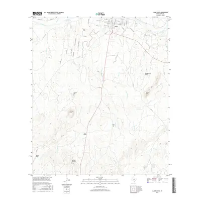
2016 Map of Llano South
USGS Topo · Published 2016About this map
The Llano River carves through the northern edge of this landscape, providing a focus for the southern residential and commercial grid of Llano. This 2016 survey illustrates the town's expansion toward Llano Park Lake and along major thoroughfares like W Wallace St and E Green St. South of the river, the topography rises into the characteristic peaks of the Texas Hill Country, including prominent elevations such as Hickory Mtn, Bachelor Peak, and Yearling Head Mtn.
Find a feature on this map
57 named features on this map. Tap any name to fly to it.
Don’t see what you’re looking for? This feature index may not catch every label — zoom into the map to look around manually.
Map Details
Editions of this 2016 Llano South Map
This is the sole edition of this map. No revisions or reprints were ever made.
Other maps of this area

1887 · Llano
USGS Topo · 1:125,000

1894 · Llano
USGS Topo · 1:125,000

1904 · Llano
USGS Topo · 1:125,000

1909 · Llano
USGS Topo · 1:125,000

1918 · Llano
USGS Topo · 1:125,000

1954 · Llano
USGS Topo · 1:250,000

1955 · Llano
USGS Topo · 1:250,000

1955 · Valley Spring
USGS Topo · 1:24,000
1955 · Llano North
USGS Topo · 1:24,000
1955 · Valley Spring
USGS Topo · 1:62,500