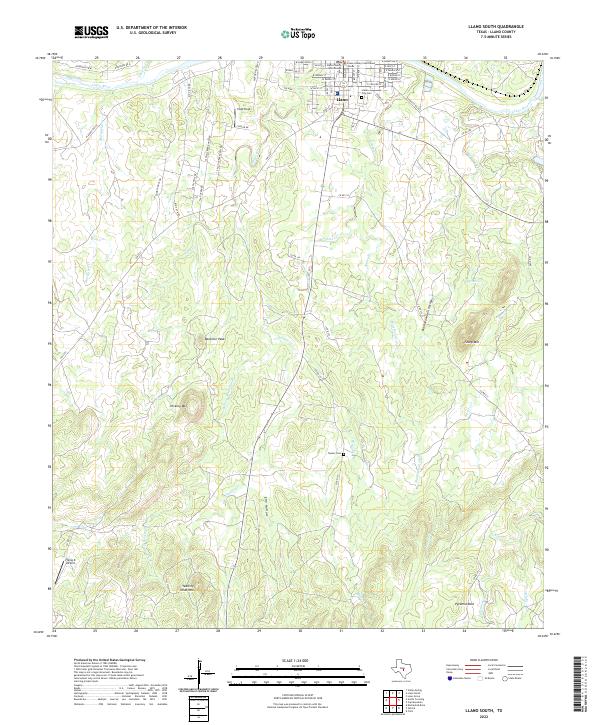
2022 Map of Llano South
USGS Topo · Published 2022About this map
Llano serves as the focal point of this Central Texas landscape, situated along the banks of the Llano River. The town's civic heart is clearly defined by the Llano County Courthouse and the Llano County Courthouse Annex, while its residential expansion is traced through a network of streets like Cedar St and Walnut St. The surrounding terrain transitions into the iconic granite uplands and drainage basins of the Llano Uplift. To the south, the topography rises toward distinct summits such as Bachelor Peak, Hickory Mtn, and the prominent Yearling Head Mtn. This area is carved by a complex system of waterways, including Oatman Cr and Flag Cr, which feed into the primary river valley. Notable local landmarks for genealogical research include Llano City Cem and the more remote Clymer Cem, alongside the geological formation at Pyramid Rock.
Find a feature on this map
68 named features on this map. Tap any name to fly to it.
Don’t see what you’re looking for? This feature index may not catch every label — zoom into the map to look around manually.
Map Details
Editions of this 2022 Llano South Map
This is the sole edition of this map. No revisions or reprints were ever made.
Other maps of this area

1887 · Llano
USGS Topo · 1:125,000

1894 · Llano
USGS Topo · 1:125,000

1904 · Llano
USGS Topo · 1:125,000

1909 · Llano
USGS Topo · 1:125,000

1918 · Llano
USGS Topo · 1:125,000

1954 · Llano
USGS Topo · 1:250,000

1955 · Llano
USGS Topo · 1:250,000

1955 · Valley Spring
USGS Topo · 1:24,000
1955 · Llano North
USGS Topo · 1:24,000
1955 · Valley Spring
USGS Topo · 1:62,500