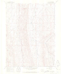
1966 Map of Lo 7 Hill
USGS Topo · Published 1969About this map
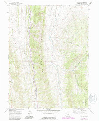
The Grand Hogback dominates this Colorado landscape, forming a massive geological spine that dictates the drainage patterns of the surrounding Rio Blanco County terrain. Surveyed in the 1960s, the map reveals a remote ranching and forest environment where water management is critical, evidenced by the Highland Ditch traversing the north. To the southeast, the boundary of the White River National Forest indicates the shift from private range land to protected federal timber and watershed areas.
Find a feature on this map
14 named features on this map. Tap any name to fly to it.
Don’t see what you’re looking for? This feature index may not catch every label — zoom into the map to look around manually.
Map Details
Editions of this 1966 Lo 7 Hill Map
5 editions found
Other maps of this area

1906 · Grand Hogback
USGS Topo · 1:125,000

1907 · White River
USGS Topo · 1:125,000

1910 · Danforth Hills
USGS Topo · 1:125,000

1910 · Grand Hogback
USGS Topo · 1:125,000

1910 · White River
USGS Topo · 1:125,000

1912 · Meeker
USGS Topo · 1:62,500

1914 · Meeker
USGS Topo · 1:62,500

1952 · No Name Ridge
USGS Topo · 1:24,000

1952 · Segar Mountain
USGS Topo · 1:24,000

1954 · Vernal
USGS Topo · 1:250,000