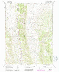
1966 Map of Lo 7 Hill
USGS Topo · Published 1988About this map
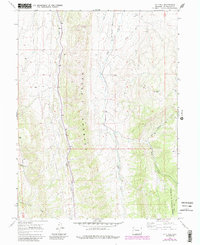
The Grand Hogback dominates this Rio Blanco County landscape, forming a massive natural barrier that dictates the flow of water and the path of human infrastructure. West of this ridge, Sheep Creek carves a narrow corridor followed by the primary roadway, while the eastern slopes drain into Miller Creek and Flag Creek. The prominence of Lo 7 Hill stands as a landmark in the northeast, marking the high ground between the drainage of Red Canyon and the surrounding plateau. Water management is evident through the presence of the Highland Ditch, which traverses the high terrain to direct flow for local use. Much of the southeast portion is protected land within the White River National Forest, where the terrain transitions into the East Fork drainage and the steep draws of Timber Gulch.
Find a feature on this map
13 named features on this map. Tap any name to fly to it.
Don’t see what you’re looking for? This feature index may not catch every label — zoom into the map to look around manually.
Map Details
Editions of this 1966 Lo 7 Hill Map
5 editions found
Other maps of this area

1906 · Grand Hogback
USGS Topo · 1:125,000

1907 · White River
USGS Topo · 1:125,000

1910 · Danforth Hills
USGS Topo · 1:125,000

1910 · Grand Hogback
USGS Topo · 1:125,000

1910 · White River
USGS Topo · 1:125,000

1912 · Meeker
USGS Topo · 1:62,500

1914 · Meeker
USGS Topo · 1:62,500

1952 · No Name Ridge
USGS Topo · 1:24,000

1952 · Segar Mountain
USGS Topo · 1:24,000

1954 · Vernal
USGS Topo · 1:250,000