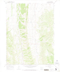
1966 Map of Lo 7 Hill
USGS Topo · Published 1970About this map
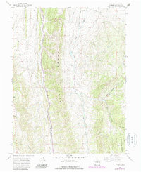
The Grand Hogback dominates this Rio Blanco County landscape, forming a dramatic spine that separates the western gulches from the eastern creek drainages. During this mid-1960s survey, the area was characterized by a sophisticated network of high-altitude irrigation, evidenced by the Highland Ditch and Miller Ditch that follow the contours of the land to manage water resources in the arid climate. The southeastern portion of the map transitions into the White River National Forest, where the terrain becomes increasingly complex around the East Fork Red Canyon. The presence of several named gulches, such as Segar Gl and Joe Bush Gl, alongside the prominent Lo 7 Hill, suggests a landscape shaped by both natural erosion and early ranching or prospecting activity. Remote Jeep Trails and a crossing Pipeline indicate the infrastructure of a working wilderness typical of the Colorado interior during this era.
Find a feature on this map
19 named features on this map. Tap any name to fly to it.
Don’t see what you’re looking for? This feature index may not catch every label — zoom into the map to look around manually.
Map Details
Editions of this 1966 Lo 7 Hill Map
5 editions found
Other maps of this area

1906 · Grand Hogback
USGS Topo · 1:125,000

1907 · White River
USGS Topo · 1:125,000

1910 · Danforth Hills
USGS Topo · 1:125,000

1910 · Grand Hogback
USGS Topo · 1:125,000

1910 · White River
USGS Topo · 1:125,000

1912 · Meeker
USGS Topo · 1:62,500

1914 · Meeker
USGS Topo · 1:62,500

1952 · No Name Ridge
USGS Topo · 1:24,000

1952 · Segar Mountain
USGS Topo · 1:24,000

1954 · Vernal
USGS Topo · 1:250,000