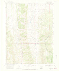
1966 Map of Lo 7 Hill
USGS Topo · Published 1969About this map
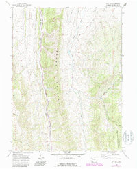
The Grand Hogback dominates this Rio Blanco County landscape, forming a massive geological spine that bisects the terrain. This 1960s survey documents a region defined by its sharp elevation changes and drainage networks, with the eastern slopes falling into the White River National Forest. Water courses like Sheep Creek and Flag Creek cut through the high country, while several named gulches, including Joe Bush Gulch and Segar Gulch, reveal the local nomenclature used by ranchers and outdoorsmen of the era. A solitary Jeep Trail provides the primary access across these ridges, highlighting the area's isolation. The survey also identifies Lo 7 Hill as a prominent local landmark, standing amidst a complex web of seasonal streams such as Miller Creek and the East Fork.
Find a feature on this map
16 named features on this map. Tap any name to fly to it.
Don’t see what you’re looking for? This feature index may not catch every label — zoom into the map to look around manually.
Map Details
Editions of this 1966 Lo 7 Hill Map
5 editions found
Other maps of this area

1906 · Grand Hogback
USGS Topo · 1:125,000

1907 · White River
USGS Topo · 1:125,000

1910 · Danforth Hills
USGS Topo · 1:125,000

1910 · Grand Hogback
USGS Topo · 1:125,000

1910 · White River
USGS Topo · 1:125,000

1912 · Meeker
USGS Topo · 1:62,500

1914 · Meeker
USGS Topo · 1:62,500

1952 · No Name Ridge
USGS Topo · 1:24,000

1952 · Segar Mountain
USGS Topo · 1:24,000

1954 · Vernal
USGS Topo · 1:250,000