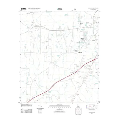
2011 Map of Loachapoka
USGS Topo · Published 2011About this map
The historic town of Loachapoka serves as the focal point of this Lee County landscape, situated where the Loachapoka Post Office and Loachapoka Cemetery mark the enduring community core. The terrain is defined by the drainage networks of Sougahatchee Creek to the north and Choctafaula Creek to the south, which are punctuated by numerous small impoundments such as Vaughans Mill Pond and Colliers Pond. For those tracing local family histories, the map identifies several smaller burial grounds scattered through the countryside, including the Frank McGuire Memorial Cemetery, Armstrong Cemetery, and Mount Vernon Cemetery. The settlement pattern transitions from the clustered lots of Loachapoka and newer developments like Ridgewood Village to the outlying rural communities of Beehive and Sand Hill.
Find a feature on this map
111 named features on this map. Tap any name to fly to it.
Don’t see what you’re looking for? This feature index may not catch every label — zoom into the map to look around manually.
Map Details
Editions of this 2011 Loachapoka Map
This is the sole edition of this map. No revisions or reprints were ever made.
Other maps of this area

1906 · Dadeville
USGS Topo · 1:125,000

1907 · Opelika
USGS Topo · 1:125,000

1909 · Opelika
USGS Topo · 1:125,000

1955 · Phenix City
USGS Topo · 1:250,000

1957 · Phenix City
USGS Topo · 1:250,000

1958 · Phenix City
USGS Topo · 1:250,000

1971 · Waverly
USGS Topo · 1:24,000

1971 · Little Texas
USGS Topo · 1:24,000
1971 · Opelika West
USGS Topo · 1:24,000

1971 · Loachapoka
USGS Topo · 1:24,000