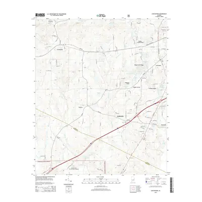
2014 Map of Loachapoka
USGS Topo · Published 2014About this map
Loachapoka and the western periphery of Auburn anchor this 2014 survey, where the rolling landscape of eastern Alabama transitions from dense suburban developments to rural forest lands. The southern portion of the sheet is dominated by the northern reaches of the Tuskegee National Forest, bordered by the Lee and Macon county line. The map highlights a complex hydrographic network, including Choctafaula Creek and Sougahatchee Creek, which feed numerous local impoundments such as Vaughans Mill Pond and Little and Stuckys Lake.
Find a feature on this map
136 named features on this map. Tap any name to fly to it.
Don’t see what you’re looking for? This feature index may not catch every label — zoom into the map to look around manually.
Map Details
Editions of this 2014 Loachapoka Map
This is the sole edition of this map. No revisions or reprints were ever made.
Other maps of this area

1906 · Dadeville
USGS Topo · 1:125,000

1907 · Opelika
USGS Topo · 1:125,000

1909 · Opelika
USGS Topo · 1:125,000

1955 · Phenix City
USGS Topo · 1:250,000

1957 · Phenix City
USGS Topo · 1:250,000

1958 · Phenix City
USGS Topo · 1:250,000

1971 · Waverly
USGS Topo · 1:24,000

1971 · Little Texas
USGS Topo · 1:24,000
1971 · Opelika West
USGS Topo · 1:24,000

1971 · Loachapoka
USGS Topo · 1:24,000