2024 Map of Loachapoka
USGS Topo · Published 2024About this map
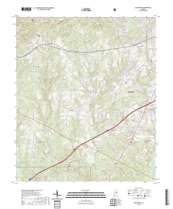
Loachapoka and the western outskirts of Auburn anchor this Lee County landscape, where the transition from traditional agricultural lands to modern research infrastructure is visible. The community of Beehive sits centrally among a network of secondary roads such as Lee Road 188 and Auburn Rd, while the southern reaches of the map transition into the protected woodlands of the Tuskegee National Forest. This modern survey documents the persistent presence of local heritage through numerous burial sites, including the Lewis Allen Foster Family Cem and Pine Knot Cem. Water resources are abundant throughout the region, defined by the winding course of Choctafaula Creek and several named impoundments like Vaughans Mill Pond and Plainsman Lake. The eastern edge highlights the growth of the university city with the inclusion of the Technology Park.
Find a feature on this map
133 named features on this map. Tap any name to fly to it.
Don’t see what you’re looking for? This feature index may not catch every label — zoom into the map to look around manually.
Map Details
Editions of this 2024 Loachapoka Map
This is the sole edition of this map. No revisions or reprints were ever made.