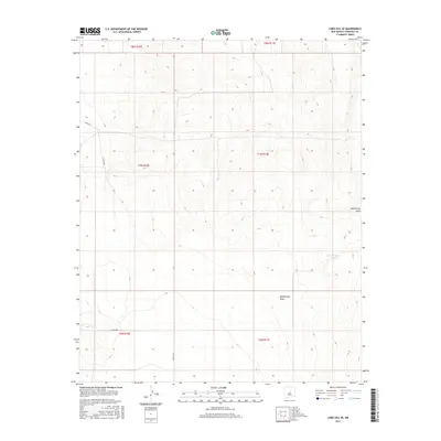
2017 Map of Lobo Hill SE
USGS Topo · Published 2017About this map
McGillivray Draw carves a path through this high-altitude landscape in Torrance County, defining the drainage patterns of an arid region near the borders of several township sections. The terrain is marked by the presence of West Douglas Tanks, which serve as vital water resources in this part of the Southwest. While the area is largely characterized by its natural contours, a network of rural routes such as Co Rd A128, Co Rd A131, and Co Rd A049 provide the primary infrastructure for traversing the interior. This 2017 survey reflects the enduring cattle-ranching and land-management character of the region, where named water features and section-line roads remain the most significant landmarks for navigating the landscape.
Find a feature on this map
11 named features on this map. Tap any name to fly to it.
Don’t see what you’re looking for? This feature index may not catch every label — zoom into the map to look around manually.
Map Details
Editions of this 2017 Lobo Hill SE Map
This is the sole edition of this map. No revisions or reprints were ever made.
Other maps of this area

1954 · Fort Sumner
USGS Topo · 1:250,000

1958 · Fort Sumner
USGS Topo · 1:250,000

1960 · Lobo Hill
USGS Topo · 1:62,500

1978 · Laguna Del Perro North
USGS Topo · 1:24,000

1978 · Pedernal Mountain
USGS Topo · 1:24,000

1978 · Pedernal
USGS Topo · 1:24,000
1978 · Rock Lake
USGS Topo · 1:24,000

1978 · Lucy
USGS Topo · 1:24,000
1984 · Vaughn
USGS Topo · 1:100,000
1990 · Lobo Hill
USGS Topo · 1:24,000