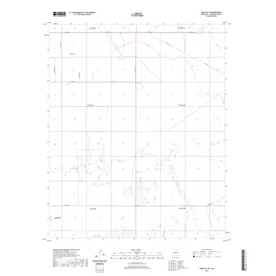
2020 Map of Lobo Hill SW
USGS Topo · Published 2020About this map
Estancia marks the southwestern reach of this high-desert landscape in Torrance County, where the transition from open basin to upland terrain begins. The map is defined by a sparse but deliberate network of local routes, including the curiously named Ice Plant Rd and Burroughs Rd, which lattice the section lines of the Estancia Valley. Water is a vital but infrequent presence, evidenced by Salt Draw and the isolated Cieneguita Spring. These features suggest a history of ranching and survival in an arid environment where reliable water sources dictated the placement of early homesteads and roads. Rising above the basin floor, the contours of Lobo Hill provide a natural landmark for navigating this expansive territory of the Manzano Mountains' eastern shadows.
Find a feature on this map
19 named features on this map. Tap any name to fly to it.
Don’t see what you’re looking for? This feature index may not catch every label — zoom into the map to look around manually.
Map Details
Editions of this 2020 Lobo Hill SW Map
This is the sole edition of this map. No revisions or reprints were ever made.
Other maps of this area

1917 · Estancia
USGS Topo · 1:125,000

1954 · Fort Sumner
USGS Topo · 1:250,000

1954 · Socorro
USGS Topo · 1:250,000

1956 · Estancia
USGS Topo · 1:62,500

1956 · Mountainair
USGS Topo · 1:62,500

1958 · Socorro
USGS Topo · 1:250,000

1958 · Fort Sumner
USGS Topo · 1:250,000

1960 · Lobo Hill
USGS Topo · 1:62,500

1962 · Socorro
USGS Topo · 1:250,000

1978 · Laguna Del Perro North
USGS Topo · 1:24,000