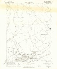
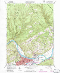
1965 Map of Lock Haven
USGS Topo · Published 1967About this map
Lock Haven serves as the focal point of this mid-1960s survey, situated where the West Branch Susquehanna River meets Bald Eagle Creek. The map documents a mature riverfront landscape defined by its academic and industrial foundations, featuring Lock Haven State College and the Lock Haven Municipal Airport. The legacy of 19th-century transport is still visible through the trace of the Pennsylvania Canal and the N Y C Pennsylvania Aqueduct near Great Island.
Find a feature on this map
72 named features on this map. Tap any name to fly to it.
Don’t see what you’re looking for? This feature index may not catch every label — zoom into the map to look around manually.
Map Details
Editions of this 1965 Lock Haven Map
5 editions found
Other maps of this area

1921 · Howard
USGS Topo · 1:48,000

1921 · Lock Haven
USGS Topo · 1:62,500

1923 · Howard
USGS Topo · 1:62,500

1923 · Lock Haven
USGS Topo · 1:62,500

1935 · Waterville
USGS Topo · 1:24,000

1937 · Waterville
USGS Topo · 1:48,000

1943 · Hyner
USGS Topo · 1:62,500

1943 · Waterville
USGS Topo · 1:62,500

1944 · Lock Haven
USGS Topo · 1:62,500

1946 · Renovo East
USGS Topo · 1:62,500