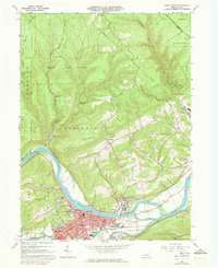
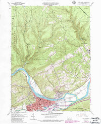
1965 Map of Lock Haven
USGS Topo · Published 1973About this map
The West Branch Susquehanna River curves dramatically through this Clinton County landscape, anchoring the industrial and educational center of Lock Haven. During this mid-century period, the town is shown in transition, with Penn Central rail lines and the remnants of the Bald Eagle Canal tracing the valley floor. The map highlights the town's institutional footprint, from the riverside campus of Lock Haven State College to the Piper Memorial Airport and several parochial institutions like Immaculate Conception Sch.
Find a feature on this map
71 named features on this map. Tap any name to fly to it.
Don’t see what you’re looking for? This feature index may not catch every label — zoom into the map to look around manually.
Map Details
Editions of this 1965 Lock Haven Map
5 editions found
Other maps of this area

1921 · Howard
USGS Topo · 1:48,000

1921 · Lock Haven
USGS Topo · 1:62,500

1923 · Howard
USGS Topo · 1:62,500

1923 · Lock Haven
USGS Topo · 1:62,500

1935 · Waterville
USGS Topo · 1:24,000

1937 · Waterville
USGS Topo · 1:48,000

1943 · Hyner
USGS Topo · 1:62,500

1943 · Waterville
USGS Topo · 1:62,500

1944 · Lock Haven
USGS Topo · 1:62,500

1946 · Renovo East
USGS Topo · 1:62,500