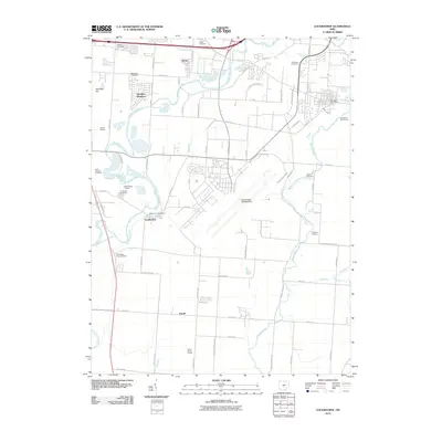
2010 Map of Lockbourne
USGS Topo · Published 2010About this map
Big Walnut Creek and Walnut Creek define the drainage of this central Ohio landscape south of Columbus. The area reflects a mix of suburban expansion and military infrastructure, anchored by the significant footprint of the Rickenbacker ANGB Airport. Significant for family researchers, several smaller burial grounds including the Paul Peters Farm Cemetery, Watkins Cemetery, and Rarey Cemetery are preserved amidst the developing road networks. The map details the proximity of the Groveport Post Office to the Groveport Golf Course, while to the west, Scioto Downs and Camp Saint Joseph stand as notable landmarks. Smaller settlements like Reese, Hamilton Meadows, and Duvall remain as distinct nodes connected by established routes like Ashville Pike and Lockbourne Rd.
Find a feature on this map
61 named features on this map. Tap any name to fly to it.
Don’t see what you’re looking for? This feature index may not catch every label — zoom into the map to look around manually.
Map Details
Editions of this 2010 Lockbourne Map
This is the sole edition of this map. No revisions or reprints were ever made.
Other maps of this area

1911 · Era
USGS Topo · 1:62,500

1913 · Era
USGS Topo · 1:62,500

1914 · Circleville
USGS Topo · 1:62,500

1923 · West Columbus
USGS Topo · 1:62,500

1925 · East Columbus
USGS Topo · 1:62,500

1925 · West Columbus
USGS Topo · 1:62,500

1943 · Era
USGS Topo · 1:62,500

1943 · Circleville
USGS Topo · 1:62,500

1943 · East Columbus
USGS Topo · 1:62,500

1947 · Columbus
USGS Topo · 1:250,000